Bathymetry
& Underwater Mapping
Accurate shallow-water and coastal bathymetric survey for marine and infrastructure projects.
Depth Accuracy
Sub-5 cm RMSE
Transducer Freq.
Dual (50 / 200 kHz)
Depth Range
0.3m to 150m Range
Platform System
Autonomous Surface Vehicle (ASV)
Underwater Acoustic Profiling
Bathymetry mappings rely on acoustic remote sensing. Echo sounders emit calibrated audio pulses downward, registering the time offsets of the echoes returning from the bed floor. Pairing these depth soundings with geodetic RTK GPS positions yields high-precision coordinate elevation profiles of the sub-surface topography.
Deploying unmanned autonomous surface vehicles (ASVs) allows us to survey shallow-water areas and hazardous tailing dams safely, avoiding risks to human crews.
Acoustic Echo Sounding
High-frequency transducers emit acoustic pulses downward, mapping the water depth based on the return signal timing reflected from the seabed.
Sound Velocity Profile (SVP)
Water temperature and salinity columns are measured to calculate acoustic velocity variations, ensuring exact depth calculations across varying densities.
RTK Tide Corrections
Active base receivers track real-time tidal height elevations, dynamically subtracting astronomical tide shifts to yield absolute bottom elevations.
Hydrographic Survey Fleet
We operate robotic autonomous surface vessels and dual-frequency transducers to capture accurate shallow water profiles.
Autonomous Surface Vehicle (ASV)
Our unmanned hydrographic surveying vessel. Features autonomous waypoint navigation mapping grids, a dual-thruster power train, and up to 4 hours of active operation. Ideal for environmental surveying in shallow tailing ponds, river estuaries, and dams.
Dual-Frequency Echo Sounder
A high-precision acoustic depth sensor operating simultaneously at 50 kHz and 200 kHz frequencies. The high frequency tracks the upper silt boundaries, while the low frequency penetrates soft mud to capture the hard bottom surface layer.
Bathymetry Deliverables
Kami memproses data transduser sonar menjadi model permukaan dasar laut/sungai berformat GIS dan CAD.
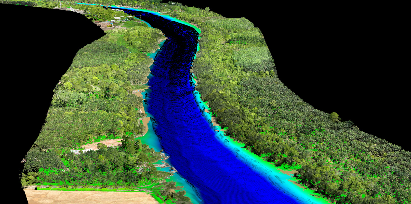
3D Seabed & Riverbed Surface
High-density 3D digital surfaces detailing the shape and topography of riverbeds, lakes, or coastal seabeds. Crucial for engineering construction and structural layouts.
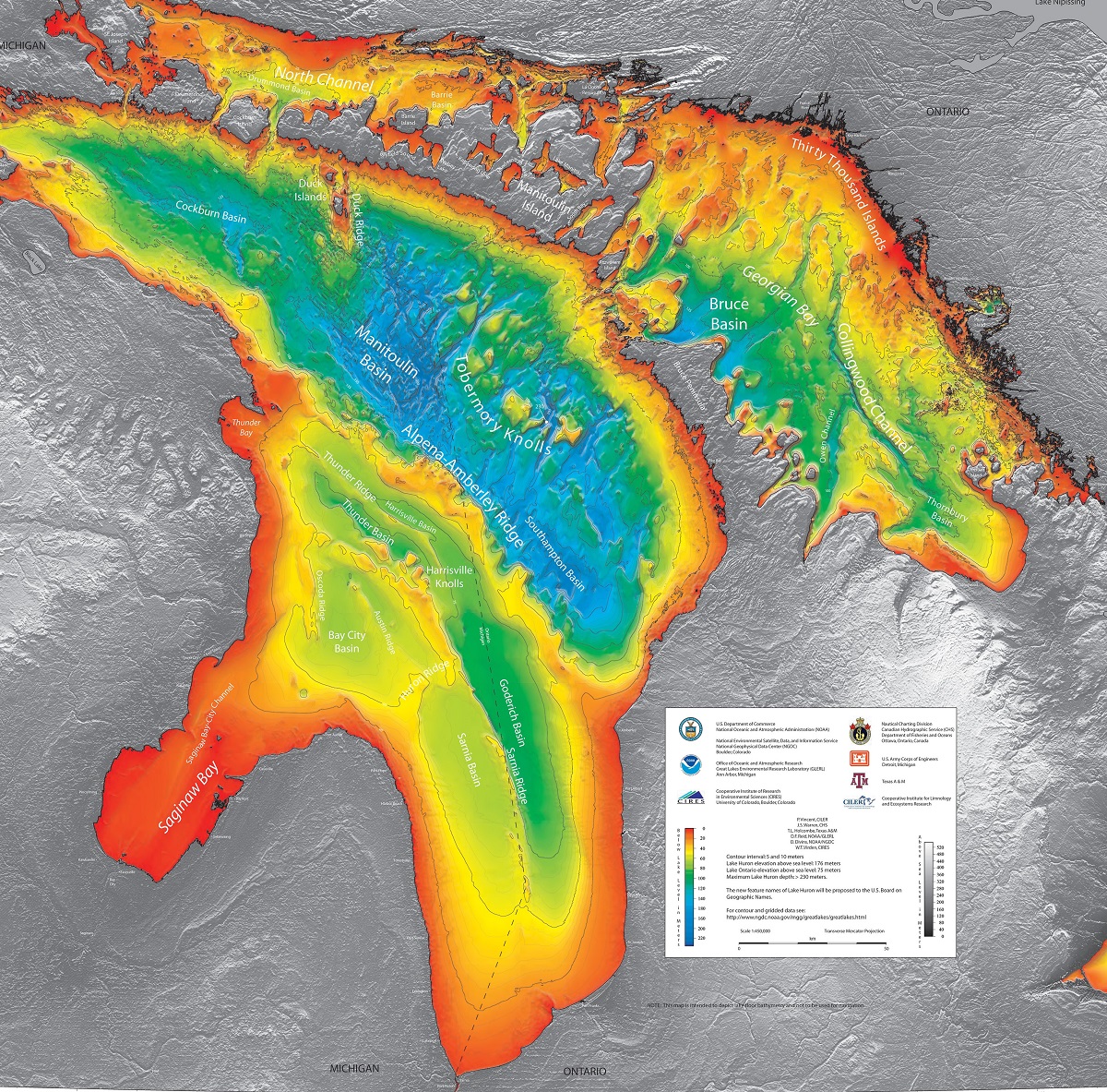
Bathymetric Contour Maps
High-precision elevation contours detailing underwater depths. Essential for harbor dredging verification and navigation charts compilation.
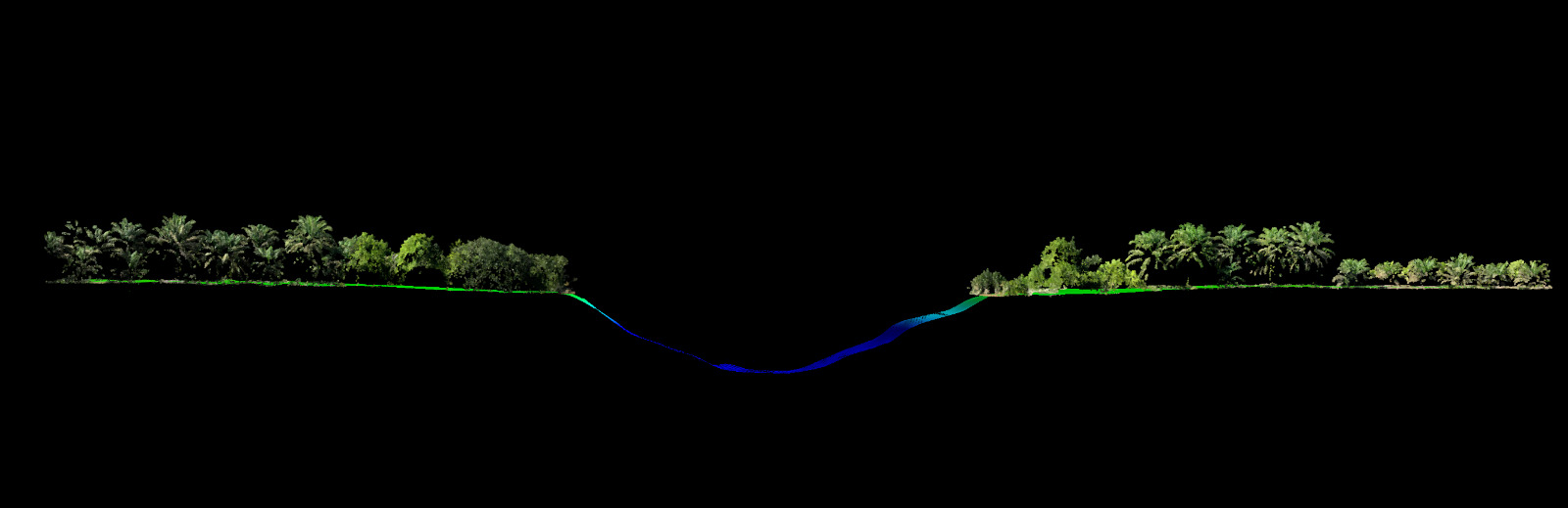
Riverbed Cross-Section Profiles
Detailed cross-sectional profiles visualizing depth offsets at specific engineering stations. Ideal for scour analysis around bridge pillars and dam structural monitoring.
Bathymetry Industry Applications
Applying underwater sonar mapping to solve navigation and engineering problems.
Port Dredging
Pre-dredge and post-dredge surveys to verify navigation channel depths and compute siltation volumes.
Bridge Scour Analysis
Mapping scour holes around bridge piers and foundations to monitor structural erosion risks.
Reservoir Capacity
Volumetric mapping of dam reservoirs to calculate water storage capacity changes due to silt buildup.
Marine Pipelines
Detailed seabed mapping along proposed underwater pipeline routes to identify obstructions.
Ready to Map Your Water Bodies?
Discuss your surveying needs with our technical team. We provide tailored solutions and accurate estimations.