Photogrammetry
& Orthomosaic Mapping
High-resolution orthomosaic and 3D surface models for mapping, inspection, and asset monitoring.
Resolution (GSD)
Sub-1.0 cm / pixel
Camera Sensor
45 MP Full-Frame
Horizontal Accuracy
1.5 cm RMSE
Vertical Accuracy
3.0 cm RMSE
How Drone Photogrammetry Works
Photogrammetry is the science of extracting geometric measurements from overlapping photographs. By flying a drone along structured grid flight lines and capturing hundreds of high-resolution visual frames, we compile datasets where each pixel is georeferenced. Using triangulation calculations and camera calibration parameters, photogrammetry software reconstructs detailed 3D models.
Unlike LiDAR which maps elevations beneath vegetation, photogrammetry captures color-realistic visual maps (orthomosaics) and textured surfaces, rendering highly detailed visible features.
High-Overlap Image Acquisition
Missions are planned using automated flight control software, capturing continuous nadir or oblique frames with 80% frontal and 75% lateral overlaps to prevent visual gaps.
Ground Control Points (GCPs)
High-contrast visual targets are surveyed on the ground using geodetic RTK GNSS receivers. These coordinates anchor the photogrammetric pixel grids to absolute global coordinates.
Structure-from-Motion (SfM)
Photogrammetry software matches hundreds of common keypoints across overlapping photos. Triangulation calculations reconstruct the exact camera geometry and 3D shapes.
GSD & FLIGHT SPECIFICATIONS
Ground Resolution (GSD)
Ground Resolution (GSD)
Ground Resolution (GSD)
Lower flight altitudes yield denser Ground Sampling Distance (GSD) for high-precision mapping.
Understanding Pixel Resolution & Flight Overlap
The accuracy of photogrammetry is determined by the Ground Sampling Distance (GSD) and the photo overlap percentage. GSD represents the physical size of each pixel on the ground. Flying lower increases the pixel resolution (sub-centimeter GSD), enabling the detection of tiny cracks or land shifts.
We maintain a minimum of 80% frontal overlap and 75% lateral overlap. This high overlap ensures that every point on the ground is captured from at least 5-8 different camera angles, eliminating blind spots and distortions around vertical structures.
Enterprise Mapping Fleet
We operate specialized, high-resolution enterprise drones equipped with mechanical global shutter cameras.
DJI Matrice 4 Enterprise
Our primary compact enterprise mapping drone. Designed for rapid deployment, it features a built-in mechanical shutter camera to completely prevent motion distortion when flying at high speeds. Equipped with an RTK module, it links to geodetic ground stations for centimeter-level coordinate accuracy.
DJI Matrice 350 / 400 RTK + Zenmuse P1
Our heavy-lift workhorse setup for large-scale operations. The Zenmuse P1 payload integrates a 45-megapixel full-frame sensor on a 3-axis stabilized gimbal. Supporting multiple lens profiles (24mm, 35mm, 50mm), it delivers ultra-dense pixel maps for complex topographies.
Photogrammetry Deliverables
Kami memproses data foto udara tumpang-tindih (overlap) tinggi menjadi produk pemetaan spasial yang detail, presisi, dan siap diintegrasikan.
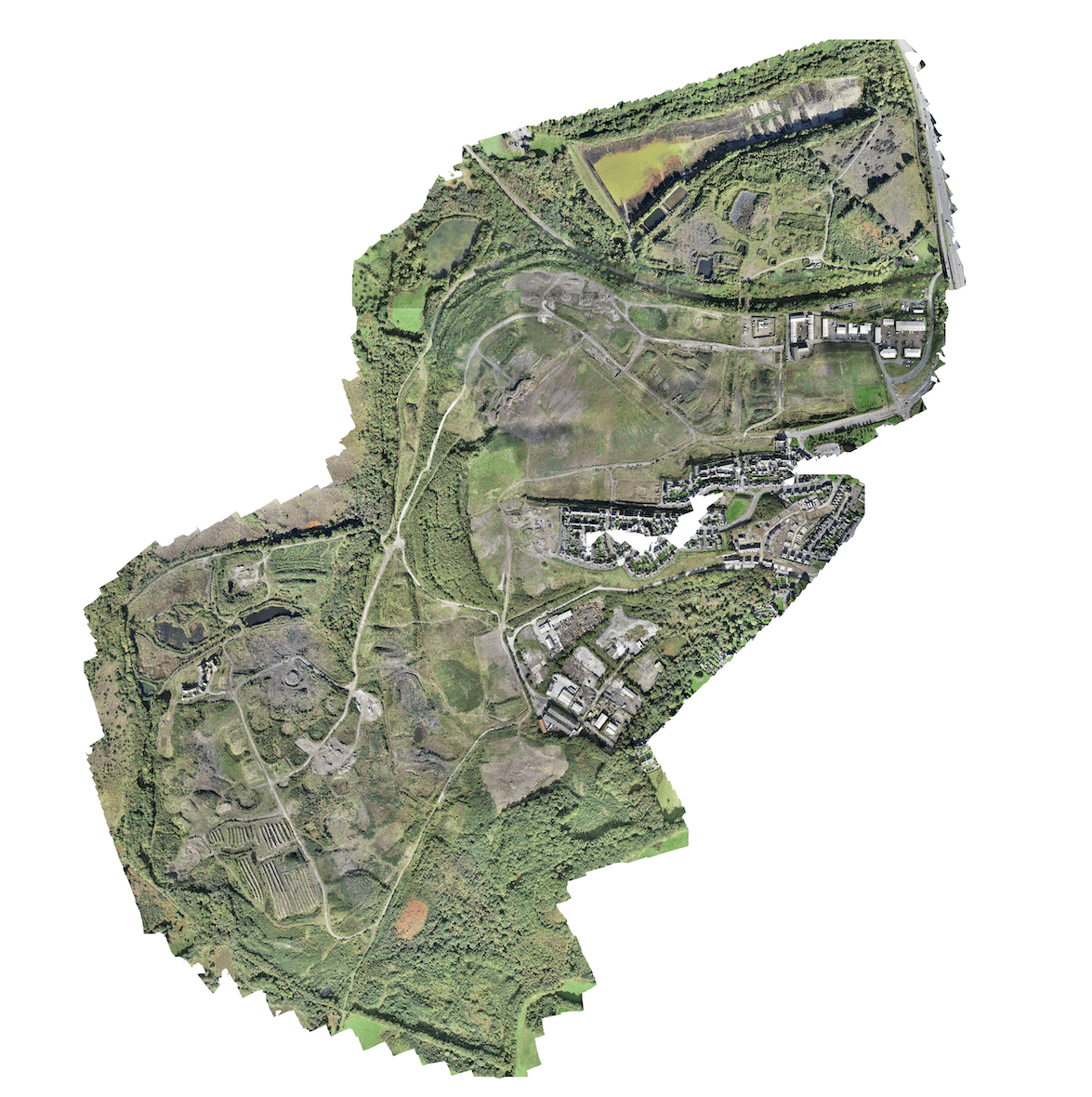
2D High-Resolution Orthomosaic Map
A georeferenced, orthorectified two-dimensional visual map compiled from thousands of high-overlap aerial photographs. Corrects lens distortions and topographic reliefs to yield absolute mapping precision at sub-centimeter resolutions.

Digital Surface Model (DSM)
Grid elevation raster capturing the top height of all structures, vegetation, and ground surfaces above the bare-earth.

Digital Terrain Model (DTM)
A bare-earth elevation raster generated by filtering out all trees, crops, and buildings from the DSM. Yields accurate underlying terrain topography.

3D Textured Mesh
A photorealistic three-dimensional mesh model reconstructed from multi-angle aerial photographs. Yields interactive visual digital twins for remote auditing.
Photogrammetry Applications
Applying high-resolution drone mapping to solve critical inspection and volume computation tasks.
Open-Cut Mining
Stockpile volume calculations, boundaries layout, and mapping of quarry faces for structural geology reviews.
Precision Agriculture
Tree crop counts, crop health mapping using NDVI sensors, and plantation boundary management.
Civil & Construction
Land grading layout, road design reviews, volume calculations of cut-and-fill soil mass.
Cadastral & Land Planning
Detailed visual boundaries layout for land ownership validation and cadastral mapping databases.
Ready to Map Your Project Site?
Discuss your surveying needs with our technical team. We provide tailored solutions and accurate estimations.