LiDAR Survey
& Mapping Solutions
High-density point cloud data for terrain modeling, deformation analysis, and vegetation penetration.
System Accuracy
Sub-5 cm Vertical
Points Per Second
240k (Single Return)
Reflective Range
250m @ 10% reflectivity
Penetration Level
Up to 5 Target Returns
How Drone LiDAR Works
LiDAR (Light Detection and Ranging) is an active remote sensing technology that projects rapid laser pulses toward the ground. By measuring the precise return times of these pulses, combined with GNSS (GPS) coordinate data and Inertial Measurement Unit (IMU) pitch and roll calculations, we generate high-density, centimeter-accurate 3D maps of both the ground and surface assets.
Unlike traditional photogrammetry, LiDAR does not rely on visual matching or daylight, meaning we can scan shadows, forested canopies, and narrow vertical assets with unmatched reliability.
Active Laser Pulse
Emits up to 240,000 laser pulses per second, measuring the time-of-flight of reflected light to calculate distances with millimeter precision.
RTK GNSS Positioning
Integrates with dual-antenna satellite receivers to establish georeferenced coordinates for every single data point in real-time.
High-Accuracy IMU
A built-in Inertial Measurement Unit continuously monitors drone roll, pitch, and yaw, correcting laser vector directions during flight.
CANOPY RETURN METRICS
Top of Tree Canopy
Understory & Branches
Bare ground surface (DTM)
Multiple returns filter vegetation cover, enabling the extraction of bare-earth contours.
Filtering Vegetation with Multi-Return Tech
One of the greatest advantages of LiDAR is its ability to penetrate vegetation. When a laser beam is fired, it does not stop at the first leaf. A single pulse can return multiple reflections as it hits gaps in the canopy, filters down through the branches, and finally bounces off the actual ground.
By processing these multiple returns, we strip away tree cover and bushes in post-processing, revealing the true ground level. This makes LiDAR the only viable surveying method for forested terrain, highway corridors, and mineral deposits covered in heavy foliage.
Enterprise Survey Equipment
We operate top-tier hardware to guarantee centimeter-level precision and data integrity.
DJI Matrice 400 RTK Platform
Our heavy-lift enterprise drone system. Designed for harsh surveying conditions, it features an IP56 weather rating, advanced obstacle avoidance sensors, and dual-battery hot-swapping for continuous operation. Equipped with integrated RTK GNSS systems, it ensures ultra-accurate aerial coordinates.
DJI Zenmuse L3 Sensor
A state-of-the-art LiDAR payload integrating an airborne scanner, high-precision self-developed IMU, and a 4/5-inch CMOS frame mapping camera. The L3 offers vertical accuracy of 3 cm, multiple target return returns (up to 5), and a scanning target range of 300 meters.
LiDAR Survey Deliverables
Kami memproses data point cloud LiDAR presisi tinggi menjadi produk pemetaan spasial detail yang siap diintegrasikan.
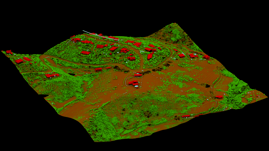
3D Classified Point Cloud
A dense cloud of georeferenced 3D coordinates, color-coded and classified into ground, high vegetation, medium vegetation, and artificial structures. Ideal for calculating tree canopy heights and engineering profiles.
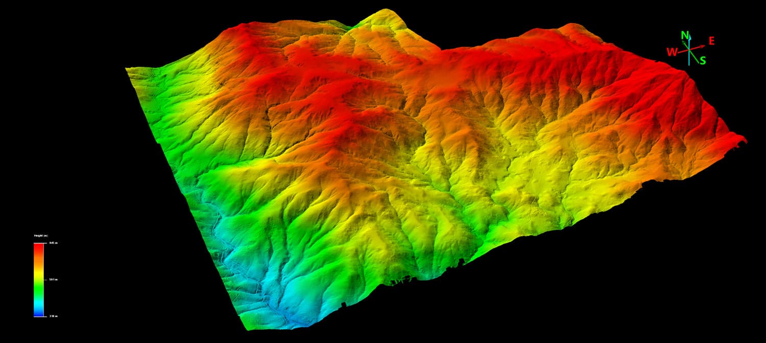
Digital Terrain Model (DTM)
A bare-earth elevation model showing the actual ground surface after software filters out all canopy, bushes, and man-made features. Vital for geological surveys, pipeline routing, and site grading.
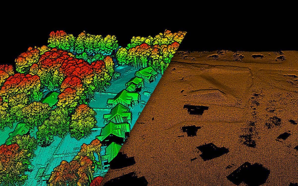
Digital Surface Model (DSM)
A model capturing the highest elevation points of all features on the surface, including canopy tops, power lines, and building roofs. Essential for urban line-of-sight reviews and canopy height maps.
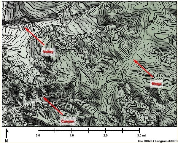
Topographic Contours
High-precision CAD-ready elevation contour lines generated at detailed intervals (e.g., 0.5m to 1m) for engineering design and drainage planning. Directly imported into AutoCAD or Civil 3D.
LiDAR Industry Applications
Serving various high-precision sectors in Indonesia with specialized geospatial workflows.
Mining & Volumetrics
Stockpile volume estimation, structural slope stability monitoring, and rapid pit excavation mapping.
Infrastructure & Roads
Corridor mapping for roads, railways, and bridges, providing structural cross-sections and terrain profiles.
Forestry & Carbon
Biomass estimation, canopy height metrics, forest inventory tracking, and environmental monitoring.
Power Line Inspection
Clearance analysis between power conductors and surrounding vegetation to identify immediate hazards.
Ready to Map Your Project Site?
Discuss your surveying needs with our technical team. We provide tailored solutions and accurate estimations.