Home
Solutions
About Us
Contact
Survey Teknologi Indonesia delivers accurate geospatial data using LiDAR, photogrammetry, and bathymetric technologies.
Delivering measurable results across Indonesia
Total Area Mapped
Projects Completed
Partner Companies
Years of Experience
"Kualitas data dan inovasi adalah kunci kesuksesan dalam setiap proyek survei dan pemetaan yang kami lakukan."
Hindrawan HM
Direktur Utama Survey Teknologi Indonesia

Companies that have collaborated with Survey Teknologi Indonesia
Survey Solutions
Survey Teknologi Indonesia delivers high-accuracy geospatial data for critical engineering, infrastructure, and environmental projects.

High-density point cloud data for terrain modeling, deformation analysis, and vegetation penetration.
Explore solution →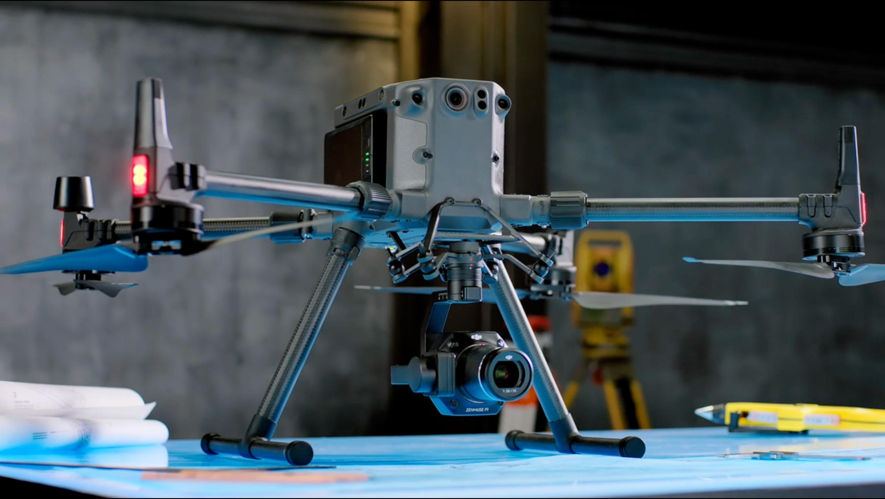
High-resolution orthomosaic and 3D surface models for mapping, inspection, and asset monitoring.
Explore solution →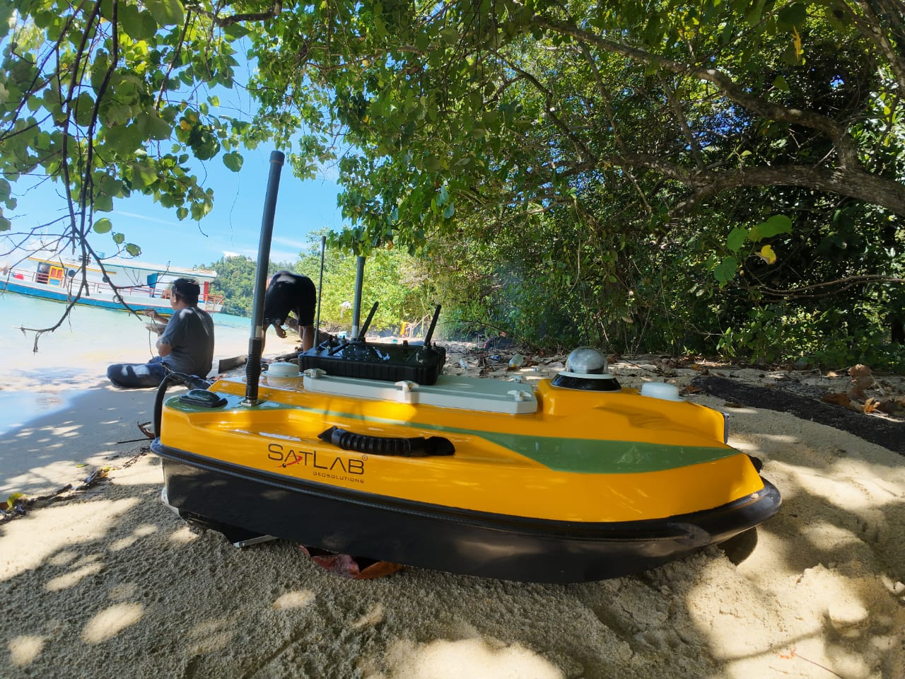
Accurate shallow-water and coastal bathymetric survey for marine and infrastructure projects.
Explore solution →
digital twin creation and spatial mapping using advanced spatial camera technology.
Explore solution →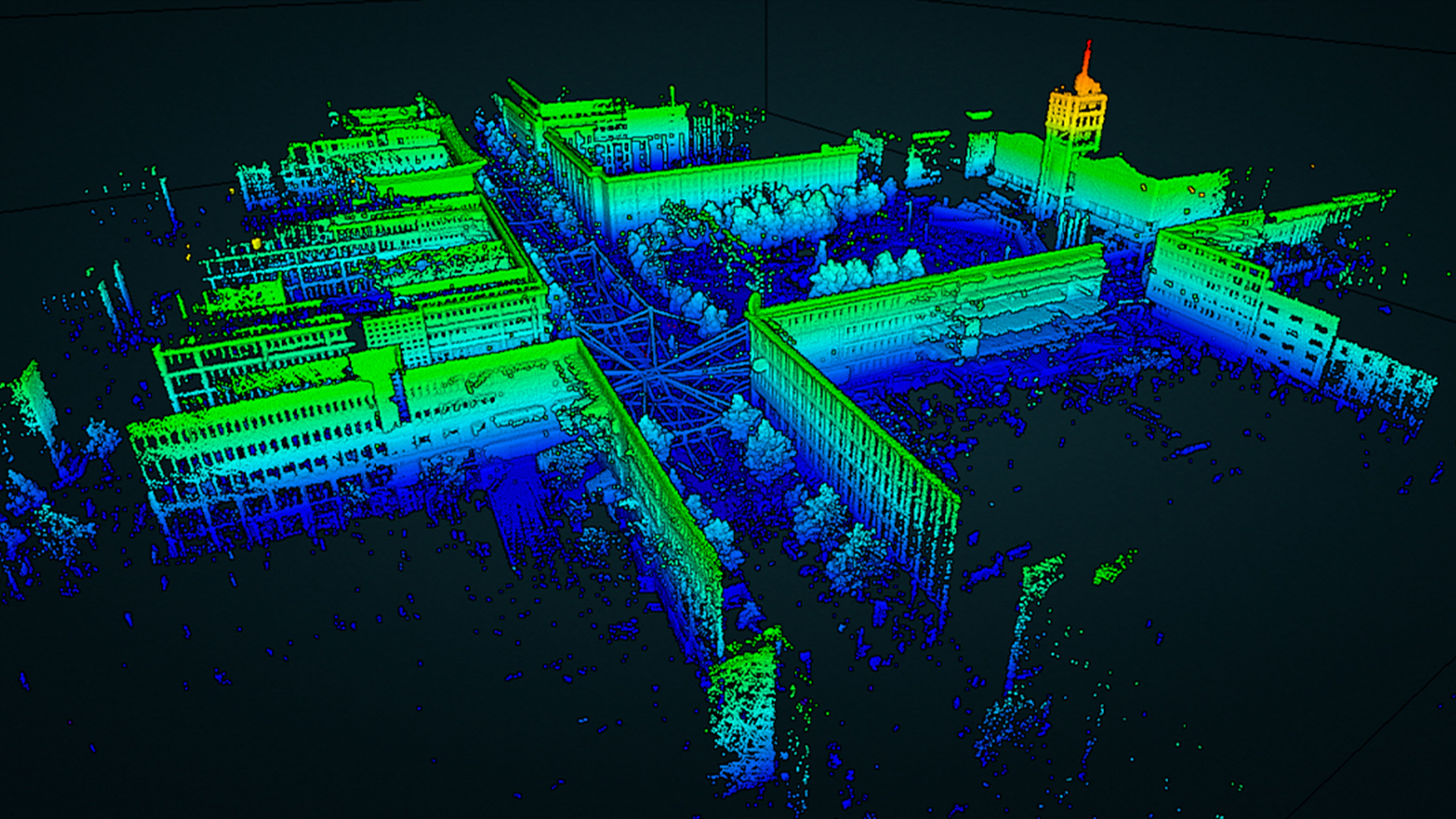
real-time 3D mapping and localization in GPS-denied environments using SLAM technology.
Explore solution →
high-precision terrestrial mapping for construction, mining, and infrastructure projects.
Explore solution →