Powerline Inspection
& Grid Safety Audits
AI-driven inspection solutions for transmission lines, identifying structural defects, hot spots, and vegetation encroachment.
Thermal Precision
±2°C Radiometric accuracy
Sensors
LiDAR, Radiometric Thermal, 45MP RGB
AI Defect Detection
Insulators, Dampers, Corrosion
Data Formats
PLS-CADD Las/Laf, CAD, PDF
Multi-Sensor Grid Analysis
By deploying intelligent utility drones equipped with multiple co-aligned sensors, we execute comprehensive grid inspections in a single flight. LiDAR sensors model precise spacing between vegetation and active conductors, radiometric infrared scanners map thermal anomalies under active load conditions, and ultra-high-resolution RGB visual cameras audit component degradation.
Our pipelines process millions of data points into highly structured maintenance and PLS-CADD compliance logs, cutting risk profiles and field team exposure.
Vegetation Encroachment Monitoring
LiDAR scanning maps the 3D distance between conductors and vegetation. Identifies growth speeds and forecasts falling tree hazards.
Thermal Defect Scanning
Radiometric thermal sensors inspect electrical splices, connectors, and switchgear under load, detecting abnormal heat anomalies before failure.
High-Res Component Audit
Ultra-high-resolution RGB cameras capture close-up details of towers, insulators, and damper weights to detect structural fatigue and rust.
Grid Inspection Fleet
We deploy advanced industrial UAV platforms equipped with enterprise-grade imaging payloads and LiDAR scanners.

DJI Matrice 4 Thermal
Our compact enterprise flagship thermal drone for utility audits. Features integrated 640x512 thermal imaging, a 48MP wide-angle camera, a 48MP telephoto camera, and a 1,800-meter laser range finder.

Zenmuse L2 UAV LiDAR System
High-performance airborne laser scanner. Features a high-accuracy IMU and multi-return capability to penetrate thick vegetation, mapping exact wire-to-canopy metrics in high definition.
Grid Deliverables
We process sensor data into standard formats compatible with leading grid engineering systems.
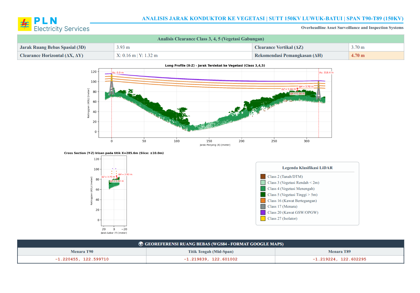
Clearance Danger Analysis
Automated calculation and analysis of distances between active conductors and surrounding vegetation, structures, or terrain to detect violation zones.
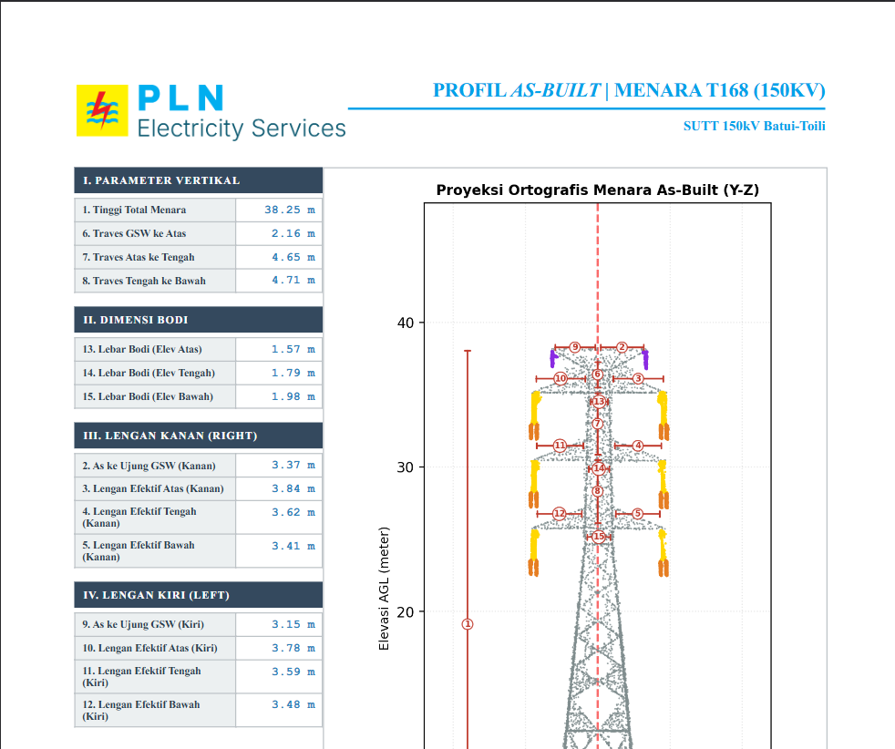
Tower Inclination & Dimension Analysis
Geodetic and photogrammetric measurement of transmission tower tilt angle, structural distortion, and physical dimensions to monitor structural health over time.
Thermal Components Detection
AI-driven inspection using radiometric thermal imaging to locate overheating components (hotspots) on insulator strings, splices, clamps, and transformers under active load.
Grid Applications
Deploying tailored aerial inspections for public utility operators and electrical asset managers.
Transmission Lines
Routine and emergency clearance monitoring along high-voltage transmission line corridors.
Distribution Grids
Rapid screening of medium-voltage distribution poles, poles, and transformers for hot spots.
Substation Inspection
Thermal and visual auditing of substation yards, switchgears, and power lines without shut-offs.
Disaster Recovery
Rapid aerial reconnaissance to locate downed lines, structural damage, and debris after typhoons or landslides.
Service Packages
Choose the inspection level that fits your utility requirements. Standardized formats ready for engineering import.
Silver Package
Standard corridor inspection and clearance validation using LiDAR sensors.
Gold Package
Comprehensive grid monitoring featuring tower structure audits and hot-spot detection.
Platinum Package
Ultimate grid inspection including complete orthomosaic mapping and digital elevation models.
- •2D RoW Orthomosaic Map
- •Digital Elevation Models (Digital Surface Model & Digital Terrain Model)
Ready to Inspect Your Grid?
Discuss your surveying and inspection needs with our technical team. We provide tailored solutions and accurate estimations.