Terrestrial Mapping
& Geodetic Survey Solutions
High-precision terrestrial mapping for construction, mining, and infrastructure projects.
Angular Accuracy
2" (Arc Seconds)
Reflectorless Range
Up to 1000m
RTK Precision
H: 8mm / V: 15mm
Tilt Compensation
IMU Tilt up to 60°
Traditional & Modern Geodetic Surveys
Terrestrial mapping is the foundation of civil construction and legal zoning audits. By deploying electronic total stations to measure precise optical vectors, and geodetic RTK GPS rovers to resolve multi-constellation satellites, we anchor physical boundaries with georeferenced benchmarks.
All benchmarks are referenced directly to the CORS BIG (Badan Informasi Geospasial) satellite stations link, ensuring compliance with legal Pertanahan (BPN) standards.
Total Station Traverses
Measures precise horizontal and vertical angles along closed traverses to compute local benchmark positions with sub-millimeter relative accuracy.
RTK GNSS Positioning
Links multi-constellation base and rover receivers to receive real-time positioning signals, defining absolute geodetic coordinates on site.
Precision Boundary Staking
Extracts coordinates directly from engineering CAD designs and places physical markers on site to define alignments and borders.
Geodetic Survey Instruments
We operate geodetic total stations and visual tilt-compensated base/rover receiver stations.
Efix TS Total Station
Our high-precision optical mapping total station. Offers reflectorless distance measurements up to 1000 meters and 2 arc-seconds angular accuracy, making it ideal for column grids layout and civil engineering audits.
Efix F7+ / F8 GNSS Receivers
Multi-constellation RTK base and rover sets. Equipped with IMU tilt compensation (up to 60° tilt) and camera AR visual staking (F8 model), enabling fast and precise topographic coordination in rugged environments.
Terrestrial Deliverables
Kami menyerahkan laporan koordinat, peta kontur AutoCAD, dan as-built drawing standar konstruksi.
Boundary Layout Survey
High-precision boundary lines and property stakes defining cadastral borders. Crucial for land acquisitions, zoning compliance, and legal property divisions.

Topographic CAD Drawings
CAD engineering drawings detailing ground contours, terrain elevations, existing utilities, roads, structures, and trees. Plugs directly into civil grading designs.
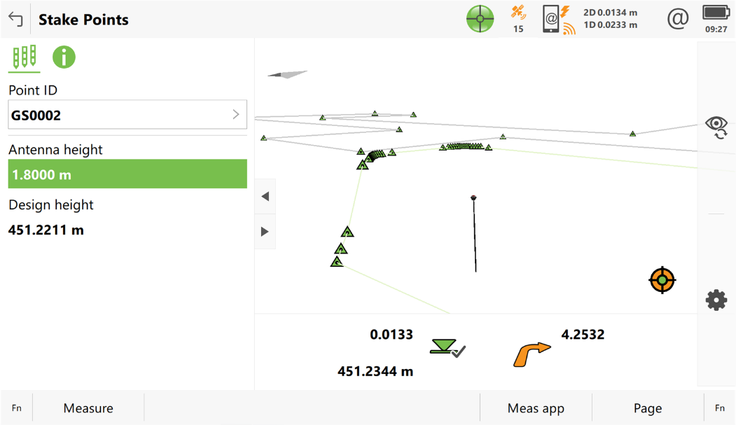
Coordinate Staking Report
Detailed report lists showing targeted stakes vs actual coordinates and structural deviations, validating layout compliance on site.
Terrestrial Industry Applications
Applying optical and geodetic measurements to support construction, subdivisions, and civil setups.
Land Cadastral
Defining legal property boundaries for registration, disputes resolution, and land subdivisions.
Foundation Layout
Staking out concrete piles, structural grids, and columns coordinates on construction sites.
Road Construction
Staking alignment centerline profiles, cross-sections, and grading slope markers.
Grading Progress
Computing soil volume changes between survey intervals during land clearance and site grading.
Ready to Layout Your Site Coordinates?
Discuss your surveying needs with our technical team. We provide tailored solutions and accurate estimations.